Cyclone Murasu 2026: Landfall, Wind Speed & Name Meaning
Cyclone Murasu 2026 crossed Andhra Pradesh near Ongole on November 3. Learn about its landfall, wind speed, name meaning and UPSC/MPSC facts.
Cyclone Murasu 2026 crossed Andhra Pradesh near Ongole on November 3. Learn about its landfall, wind speed, name meaning and UPSC/MPSC facts.
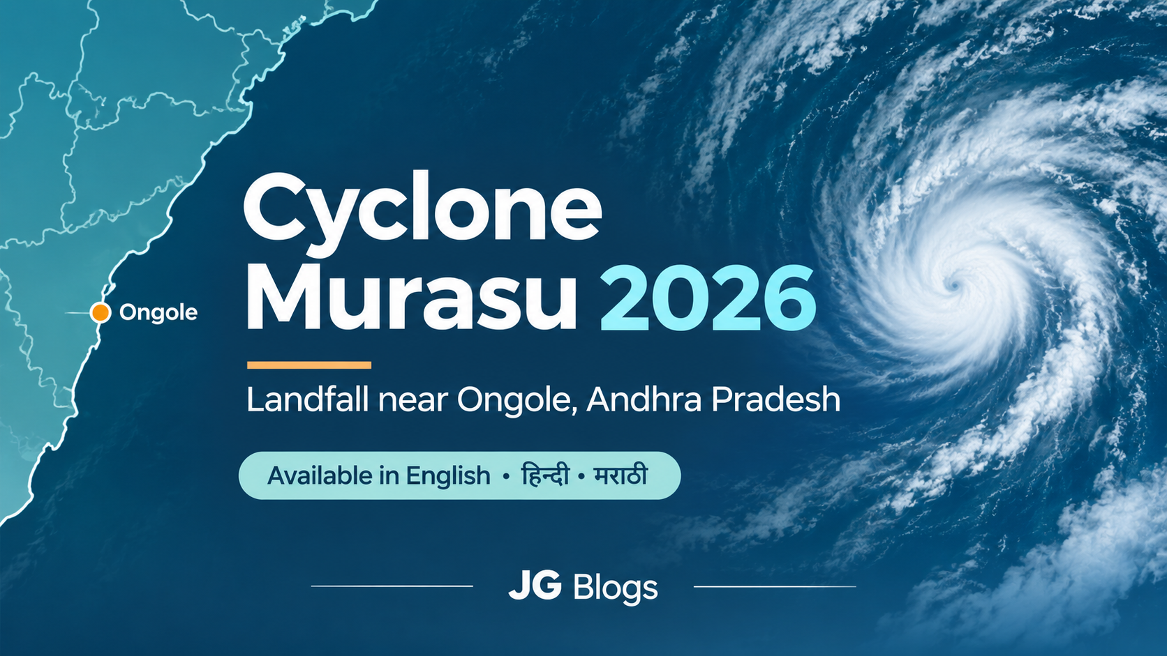
Published: 3 November 2026 | Geography & Current Affairs
Severe Cyclonic Storm Murasu crossed the south Andhra Pradesh coast near Ongole in the early hours of Tuesday, 3 November 2026, bringing strong winds and heavy rainfall.
According to the India Meteorological Department (IMD), the cyclone crossed the coast between 3:30 AM and 5:30 AM IST, with sustained wind speeds of 100–110 km/h and gusts reaching 120 km/h.
Murasu developed over the Bay of Bengal and became a severe cyclonic storm before reaching the coast. It also raised concerns about flooding, coastal damage and the safety of people living in low-lying areas.
Here's what happened, why the cyclone was named Murasu, and what makes the Bay of Bengal so vulnerable to such storms.
Cyclone Murasu crossed the Andhra Pradesh coast between Nellore and Narsapur, close to Ongole, on the morning of 3 November.
The landfall process began at around 1 AM, when the storm's outer cloud bands started moving over the coast. The cyclone completed its coastal crossing between 3:30 AM and 5:30 AM.
At landfall, the IMD classified Murasu as a Severe Cyclonic Storm.
This classification is based on sustained wind speed, not the strongest individual gust. Under the IMD system, a severe cyclonic storm has sustained winds of approximately 89–117 km/h.
Murasu did not become a severe cyclone overnight. It strengthened in stages as it moved across the Bay of Bengal.
31 October: A depression was identified over the Bay of Bengal.
1 November: The system strengthened into a cyclonic storm and received the name Murasu.
2 November: It intensified into a severe cyclonic storm while approaching Andhra Pradesh.
3 November: It crossed the coast near Ongole during the early morning.
After landfall, the system was expected to weaken gradually as it moved inland. However, weakening winds do not necessarily mean the danger from heavy rainfall has ended.
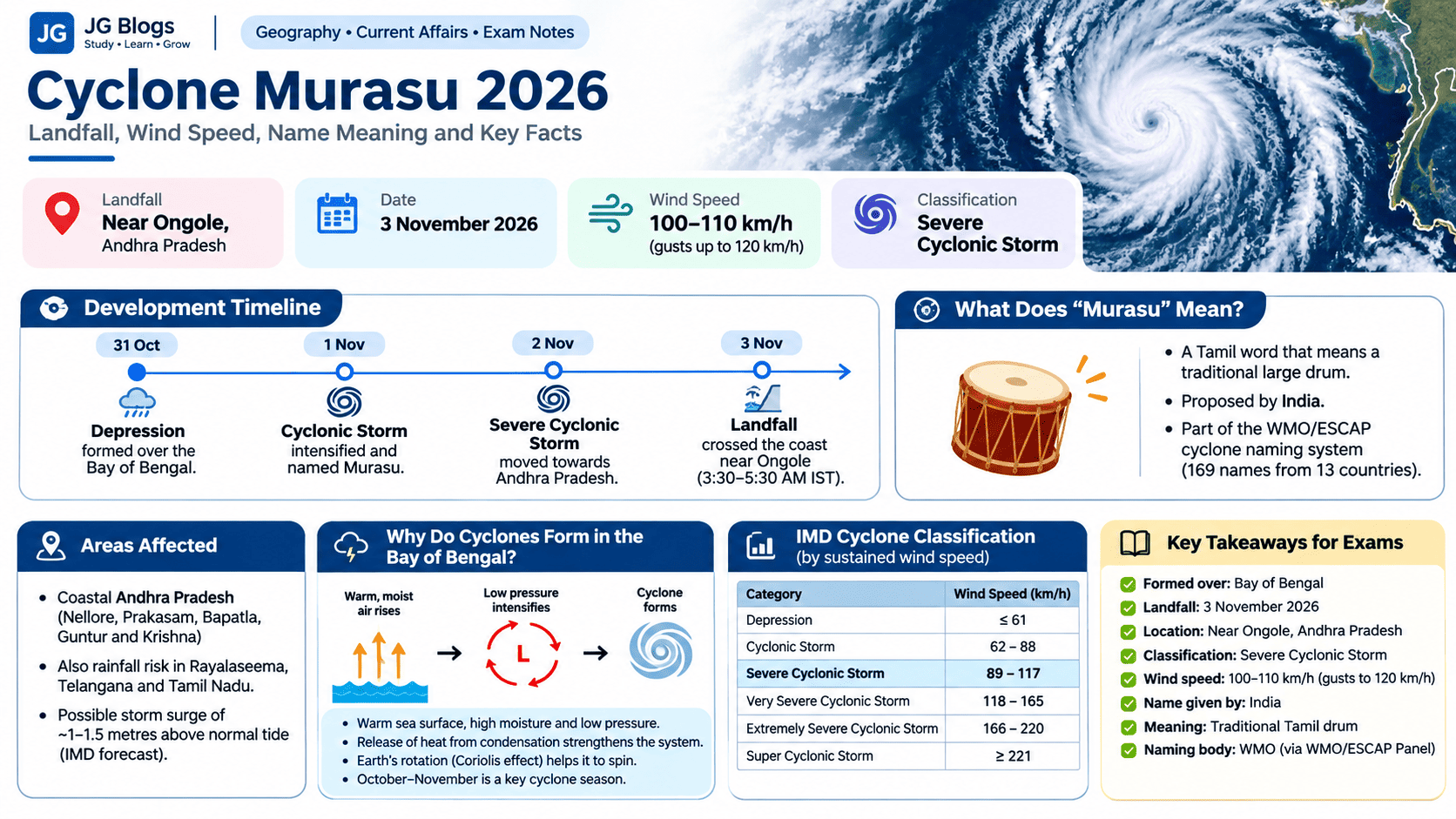
Coastal Andhra Pradesh faced the most immediate threat, particularly areas around Nellore, Prakasam, Bapatla, Guntur and Krishna.
Strong winds and heavy rain created risks of waterlogging, fallen trees, damaged power lines and disruption to transport.
The IMD also warned that a storm surge of approximately 1–1.5 metres above the normal astronomical tide could affect low-lying coastal areas. This was a forecast, not a measurement of how much flooding actually occurred.
Rainfall warnings extended beyond the landfall area, with parts of Rayalaseema, Telangana, Tamil Nadu and nearby regions also at risk of heavy rain.
Authorities carried out precautionary evacuations and issued safety warnings. Residents in affected areas should continue following official instructions even after the cyclone weakens.
For updated warnings, visit the India Meteorological Department.
The name Murasu comes from Tamil. It refers to a traditional large drum that was historically used during celebrations, ceremonies and to communicate important messages.
India proposed the name Murasu as part of the official cyclone naming system for the North Indian Ocean.
Interestingly, the name was not chosen because the cyclone was approaching India. Cyclone names are selected from a list agreed upon in advance by participating countries.
The World Meteorological Organization (WMO) coordinates this system through its regional cyclone arrangements.
In 2020, a list of 169 names was introduced, with 13 names contributed by each of 13 countries.
The list covers cyclones that form over both the Bay of Bengal and the Arabian Sea.
Naming storms makes it easier for weather agencies, governments and the public to identify them and communicate warnings. A cyclone's name does not indicate its strength.
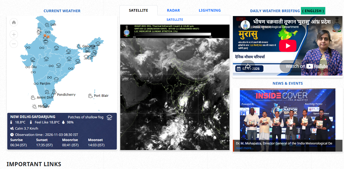
The Bay of Bengal experiences tropical cyclones particularly during the pre-monsoon and post-monsoon seasons. October and November are important months for cyclone activity in this region.
But why?
A cyclone needs warm ocean water, moisture and suitable atmospheric conditions to develop.
When warm, moist air rises above the sea, it creates an area of low pressure. More surrounding air moves towards this area and rises as well. As water vapour condenses into clouds, it releases heat that can help the system grow stronger.
The Earth's rotation also causes the moving air to turn. Under favourable conditions, the system can develop into an organised rotating storm.
The Bay of Bengal provides conditions that can support this process. Its coastal geography also makes some areas vulnerable to storm surges, especially where low-lying land meets the sea.
Not every low-pressure system becomes a cyclone. Changes in wind speed and direction at different heights, ocean temperatures and other atmospheric conditions influence whether a storm strengthens or weakens.
Question | Answer |
|---|---|
When did Cyclone Murasu make landfall? | 3 November 2026 |
Where did it make landfall? | Near Ongole, Andhra Pradesh |
Which sea did it develop over? | Bay of Bengal |
What was its classification at landfall? | Severe Cyclonic Storm |
What was its sustained wind speed at landfall? | 100–110 km/h |
Which country proposed the name Murasu? | India |
What does Murasu mean? | A traditional Tamil drum |
Which organisation coordinates the regional naming system? | WMO, through the WMO/ESCAP Panel on Tropical Cyclones |
1. Cyclone Murasu developed over which water body?
A. Arabian Sea
B. Bay of Bengal
C. Indian Ocean near Madagascar
D. Gulf of Mannar
2. Which country contributed the name Murasu?
A. Bangladesh
B. Sri Lanka
C. India
D. Thailand
3. According to the IMD classification, what is the sustained wind-speed range of a Severe Cyclonic Storm?
A. 31–49 km/h
B. 50–61 km/h
C. 62–88 km/h
D. 89–117 km/h
Answers: 1–B, 2–C, 3–D.
Cyclone Murasu is another reminder of how quickly weather conditions can change along India's eastern coast.
While its landfall near Ongole was an important weather event, understanding how the cyclone formed, how it was classified and why it received its name also makes it relevant for students preparing for Geography and current-affairs examinations.
Most importantly, a cyclone's impact does not always end when it crosses the coast. Heavy rainfall and flooding can remain dangerous even after wind speeds begin to fall.
India Meteorological Department — Official Weather Bulletins
World Meteorological Organization — North Indian Ocean Cyclone Names
Reuters — Cyclone Murasu Makes Landfall on India's Eastern Coast
Note: This article describes the situation reported on the morning of 3 November 2026. For current cyclone warnings and safety instructions, refer to IMD and local disaster management authorities.
Written by
Jayesh Gavit
IT Engineer & Content Creator, JGblogs
IT engineer with a passion for technology and building things. Started JGblogs in 2026 to share information and make government schemes, jobs, and career guides accessible to every Indian — free, in their own language.
About the author →Article
Information Quality
4 November 2026·1,250 views